| Loki Stone - 8th Century - The only one in the UK and one of two in Europe |
Sunday, August 25, 2013
Day 9: Kirkby Stephen Day II
Day 8: Scar Side to Kirkby Stephen
Subtitle: Land of the Lost.
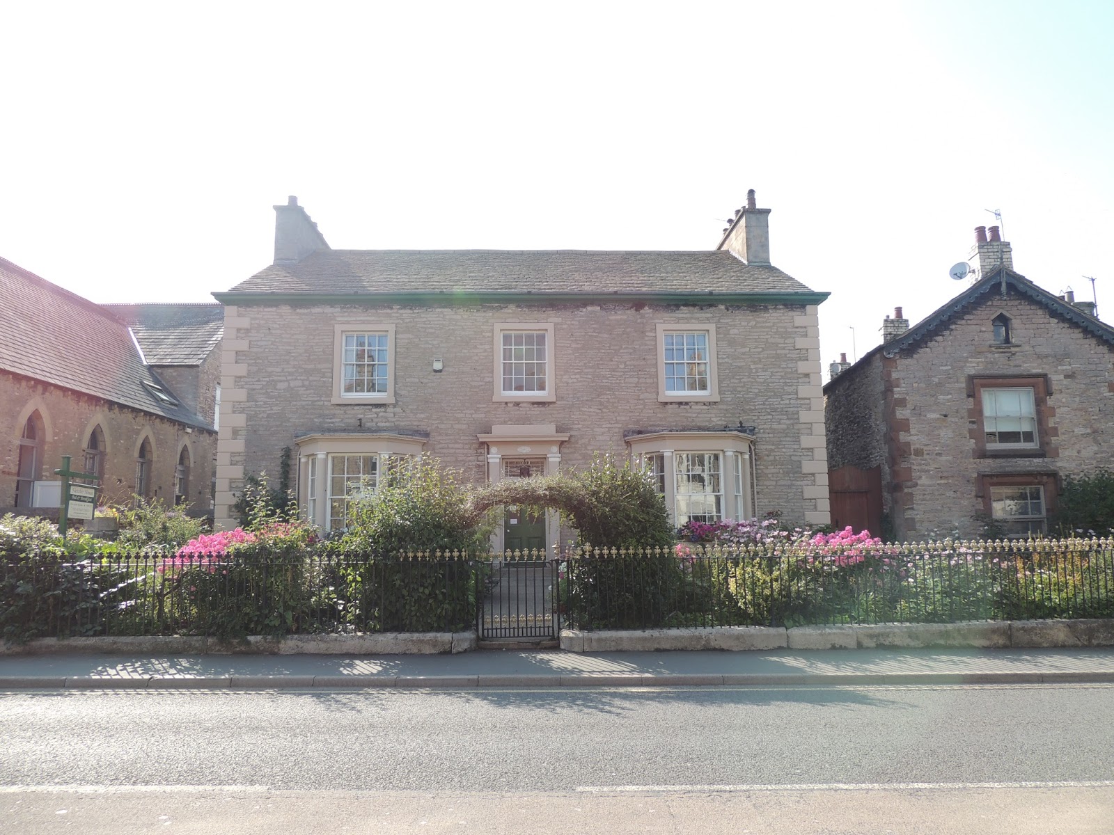
After breakfasting with our hosts at the lovely Scar Side Farm and well-wishing all our fellow hikers (all of whom set out before us), we finally set off toward Kirkby Stephen (pronounced Kirby Stephen apparently). The proprietor gave us a helpful "shortcut" to the Stone Circle just outside Orton. "Follow the lane there until the second farm then the public footpath to Knott Lane." In our experience it ended up being NOT Lane, because despite the path being directly in front of us, the gate appeared hopelessly closed. We went through a sheep pen of bleating lambs and then around the ubiquitous stone fence and about a half mile in, we recognized we were headed in a direction not suitable to our goal. It was raining and after standing in the pasture getting rained on, we decided to go back to the Scar Side Farm and ask for help. Off we went, but when we got there, the cupboard was bare...i.e., the whole fam damily had left the place empty. The chickens were not helpful and finally the luggage transfer man came up. No help there. He's not walking after all. Eventually, the mistress of the house showed back up and told us, "Just go through the gate." Paul explained that we were unable to open the latch and she said, "Just lift the gate up and take out the slack." That goes to show you that 4 undergraduate degrees , 3 graduate degrees (including one in engineering)and 3 fellowships do not equal about 3 oz of common sense. Oh well. Let's just say the initial head scratching set the tone for the day. We had wasted an hour and pretty much knew we'd be the last draggers into Kirkby for the night. That is until we met all the people who had left before we did and got lost at the stone circle, who apparently had gotten lost themselves for roughly an hour. We then managed to do quite a bit of walking mostly over open moor land with Stuart Swift, our new buddy from the south of England. Parts of the path were marked well and we were in the constant company of horses and riders and calls of "Horse behind." Ordinarily, I would have taken offense at that, but it just meant, "Get out of the way!" (Or did it?) We trekked over field after field and finally to the (now dreaded) Bent Farm. Somewhere in the vicinity of the farm, apparently, we were supposed to turn right and pass under some telegraph wires. Did we do that? Apparently not! After trekking off down a gravel road and speaking with some lovely gents who were theoretically repairing the malfunctioning electric fence and who told us we were definitely well on our way to Kirkby, we realized that the town in the distance was actually Crosby Garrett and that we'd made about a 1.5 mile mistake. On the bright side, the rain had stopped. So we couldn't stand around in a pasture cogitating in the rain, but we were "outstanding in the field." Eventually, with the help of Paul's GPS, we oriented toward the Smarsdale Bridge and headed toward the goal of Kirkby Stephen rejoining the path somewhere in the middle of nowhere. From Smarsdale Bridge, things went pretty well following the stone walls and paths through muddy, boggy heather through a railroad tunnel past some Power Bar begging miniature horses into town. We arrived in Kirkby Stephen to find that none of the other hikers from Scar Side had arrived meaning they got more lost than we did! Shortly, the two ladies from Oregon ended up at our lovely lodging, Fletcher House and asked, "Did you guys get lost at that farm?" We left Stuart to his lunch just before Bent Farm, but noticed later in the day that he still hadn't picked up his bag. So we figured everyone made the same mistake turning a 11 mile hike into a nearly 15 mile one. As my dad would say, "Oh my aching back!" We had a reservation to eat at the really tasty Black Bull Pub and although very good, it was similar to a fine dining experience in Atlanta or New York...it took about 3 hours only with pub food. But good pub food mind you. If ever in the vicinity, I highly recommend the lamb shoulder. You can cry on it about spending all day lost.
Paul's ponderings: Despite all our missed turnoffs, we still got to Kirkby Stephen about 4 pm. After having dirty clothes in the suitcase for a week, we decided to do laundry. We walked a short distance to the local laundrette. Our clothes could have served as chemical weapons from the smell of them -- despite cool weather, all this hiking has generated a lot of sweat. Once again, despite all our advanced education, after pumping eight pounds into the machine, it would not wash. Turn out the owner of the chippy shop (fish and chip shop to the non-UKers out there) owned the laundrette, so he came out after a visit. "Just pound the machine a bit" he said, "I was going to put up a sign". After a few knocks, the coins dropped and, voila, clean clothes about 90 minutes later, including the dryer. What a relief. As noted above, without the GPS in hand, we would have had a big problem -- thank you Garmin for good maps. And, we followed that old rule of thumb of "when you are in a hole, quit digging" and turned around and found our way back rather than sorting it out from Crosby Garrett onward. Kirkby Stephen is a decent sized burg, but like many towns thru here, most of it lies along the main road or just off it, so it's long and skinny. In general, we are glad to have a day's rest ahead, because after 80 miles "official path" and another 10 miles or so of "unofficial path", we're ready for a layover.
Some things we've learned not to believe:
- "Follow the obvious path" -- it's never obvious.
- "It's a short distance" and its cousin "It won't take long" -- It isn't and it will.
- "The worst is behind you" -- not.
After breakfasting with our hosts at the lovely Scar Side Farm and well-wishing all our fellow hikers (all of whom set out before us), we finally set off toward Kirkby Stephen (pronounced Kirby Stephen apparently). The proprietor gave us a helpful "shortcut" to the Stone Circle just outside Orton. "Follow the lane there until the second farm then the public footpath to Knott Lane." In our experience it ended up being NOT Lane, because despite the path being directly in front of us, the gate appeared hopelessly closed. We went through a sheep pen of bleating lambs and then around the ubiquitous stone fence and about a half mile in, we recognized we were headed in a direction not suitable to our goal. It was raining and after standing in the pasture getting rained on, we decided to go back to the Scar Side Farm and ask for help. Off we went, but when we got there, the cupboard was bare...i.e., the whole fam damily had left the place empty. The chickens were not helpful and finally the luggage transfer man came up. No help there. He's not walking after all. Eventually, the mistress of the house showed back up and told us, "Just go through the gate." Paul explained that we were unable to open the latch and she said, "Just lift the gate up and take out the slack." That goes to show you that 4 undergraduate degrees , 3 graduate degrees (including one in engineering)and 3 fellowships do not equal about 3 oz of common sense. Oh well. Let's just say the initial head scratching set the tone for the day. We had wasted an hour and pretty much knew we'd be the last draggers into Kirkby for the night. That is until we met all the people who had left before we did and got lost at the stone circle, who apparently had gotten lost themselves for roughly an hour. We then managed to do quite a bit of walking mostly over open moor land with Stuart Swift, our new buddy from the south of England. Parts of the path were marked well and we were in the constant company of horses and riders and calls of "Horse behind." Ordinarily, I would have taken offense at that, but it just meant, "Get out of the way!" (Or did it?) We trekked over field after field and finally to the (now dreaded) Bent Farm. Somewhere in the vicinity of the farm, apparently, we were supposed to turn right and pass under some telegraph wires. Did we do that? Apparently not! After trekking off down a gravel road and speaking with some lovely gents who were theoretically repairing the malfunctioning electric fence and who told us we were definitely well on our way to Kirkby, we realized that the town in the distance was actually Crosby Garrett and that we'd made about a 1.5 mile mistake. On the bright side, the rain had stopped. So we couldn't stand around in a pasture cogitating in the rain, but we were "outstanding in the field." Eventually, with the help of Paul's GPS, we oriented toward the Smarsdale Bridge and headed toward the goal of Kirkby Stephen rejoining the path somewhere in the middle of nowhere. From Smarsdale Bridge, things went pretty well following the stone walls and paths through muddy, boggy heather through a railroad tunnel past some Power Bar begging miniature horses into town. We arrived in Kirkby Stephen to find that none of the other hikers from Scar Side had arrived meaning they got more lost than we did! Shortly, the two ladies from Oregon ended up at our lovely lodging, Fletcher House and asked, "Did you guys get lost at that farm?" We left Stuart to his lunch just before Bent Farm, but noticed later in the day that he still hadn't picked up his bag. So we figured everyone made the same mistake turning a 11 mile hike into a nearly 15 mile one. As my dad would say, "Oh my aching back!" We had a reservation to eat at the really tasty Black Bull Pub and although very good, it was similar to a fine dining experience in Atlanta or New York...it took about 3 hours only with pub food. But good pub food mind you. If ever in the vicinity, I highly recommend the lamb shoulder. You can cry on it about spending all day lost.
Paul's ponderings: Despite all our missed turnoffs, we still got to Kirkby Stephen about 4 pm. After having dirty clothes in the suitcase for a week, we decided to do laundry. We walked a short distance to the local laundrette. Our clothes could have served as chemical weapons from the smell of them -- despite cool weather, all this hiking has generated a lot of sweat. Once again, despite all our advanced education, after pumping eight pounds into the machine, it would not wash. Turn out the owner of the chippy shop (fish and chip shop to the non-UKers out there) owned the laundrette, so he came out after a visit. "Just pound the machine a bit" he said, "I was going to put up a sign". After a few knocks, the coins dropped and, voila, clean clothes about 90 minutes later, including the dryer. What a relief. As noted above, without the GPS in hand, we would have had a big problem -- thank you Garmin for good maps. And, we followed that old rule of thumb of "when you are in a hole, quit digging" and turned around and found our way back rather than sorting it out from Crosby Garrett onward. Kirkby Stephen is a decent sized burg, but like many towns thru here, most of it lies along the main road or just off it, so it's long and skinny. In general, we are glad to have a day's rest ahead, because after 80 miles "official path" and another 10 miles or so of "unofficial path", we're ready for a layover.
Some things we've learned not to believe:
- "Follow the obvious path" -- it's never obvious.
- "It's a short distance" and its cousin "It won't take long" -- It isn't and it will.
- "The worst is behind you" -- not.
| Two Blokes Outstanding In Their Field and Moor |
| Climbing One Of Many Stiles Along The Route |
| Smardale Bridge |
| Disused Rail Viaduct Near Smardale Bridge Fletcher House - Lodging At Kirkby Stephen |
Day 7: Bampton To Scar Side
Subtitle: Abbey Road
It was very nice to see it and we would recommend it to other visitors to Northern England. 60 miles of walking not required. You can drive right up to the car park. From the Abbey, we wandered into the modern village of Shap. It’s your typical English hamlet: a school, a church, a post office, a store or two, a pub and a coffee shop. We stopped at the coffee shop and had a scone and ordered our lunch for later in the day. Next we navigated and crossed the M-6 (the equivalent of Interstate 75) on a bridge. Stuart was particularly looking forward to the event as he has taken the M-6 to Scotland repeatedly.
From here we entered the grounds of a limestone quarry, passed the ancient Roman city of Oddendale and then meandered through a huge sheep farm (of course!), past a stone circle, and eventually over an old Roman road made of limestone. It was pretty impressive that the cobblestones are still in place. Then we continued into a ravine where the grave of Robin Hood stands. Not that anyone can actually identify it, mind you. It’s a couple of stands of rock. Albert Wainwright remarked that the structure could be anything in the world EXCEPT Robin Hood’s grave. We are pretty sure Robin Hood is mythical and that he is the coalescence of several people, so we aren’t placing much stock in the claim!
From this point, it was a relatively easy downhill amble past an old lime kiln and finally down to Scar Side Farm where we are staying the night. The farm is nice with lots of chickens, sheep and even some small horses down the way. We have a beautiful large room overlooking the wheat fields …and a most picturesque trampoline. We had a nice dinner in the nearby town of Orton and now we are getting ready to REST!
Oh yeah. One more day to Kirkby Stephen and a one day break. All who encounter us will be ecstatic that we plan to do our laundry there.
Paul’s Ponderings: After the first few days, today was a welcome respite from the mountains, even though it was 13 miles distance. And we added two to that walking into the village. We enjoyed the up and down in rolling hills and the starkness of the moors. Our nemesis, Kidsty Pike, was often seen in the distance. We even arrived at our destination about 4 pm, including multiple stops! What a change. In theory the Yorkshire Dales are going to be much easier going overall, although it will not be hill free. Shap Abbey was another example of very impressive engineering, done during the 12th century. They said when Henry the 8th shut it down, the locals raided the stone for reuse. But, what’s left is interesting, including the main tower.
| Remains of Shap Abbey Tower |
| View of M6 from C2C path bridge |
| Welcoming Committee at Scarside |
| Shap Abbey Tower |
| Salutations from The Locals |
| Well Preserved Lime Kiln Near Scarside |
Thursday, August 22, 2013
Day 6: Patterdale to Bampton
Subtitle : Ungulates and Undulates.
Why this subtitle? First of all, everywhere we go we see sheep. And secondly, they climb higher and with surer footing. And pretty much, I am sure they are laughing at me. Not only because they are superior on the mountain, but they know I am a woose. Take the two amazing people I ran into today (other than hubby.) First was Ian, the owner of the Old Water View Inn in Patterdale. There was a news article on the wall that said, "Brit Hiker on Appalachian Trail Breaks Leg and Rescued by an Armless Man." Turns out Ian is the rescued person. He says while hiking in the 100 mile Wilderness in Maine ( a very remote spot indeed--for those not familiar with the Appalachian Trail, I recommend Bill Bryson's : A Walk in the Woods), a piece of ground gave way and sent him plummeting head first and sliding on his backpack down a mountainside. He says he thought he was alright until he saw his shattered leg. Knowing he was far away from anything, he planned to spend the night on the mountain and hoped someone would come through within a day. He made a homemade splint and tried to get himself up the mountain. He began blowing six short blasts on his whistle. After some time, he began to hear a voice saying, "Hang in there, buddy. You will be okay." Ian didn't see anyone and thought he was hallucinating. He kept blowing and the voice kept responding. Eventually, he saw an armless man come out of the brush in the middle of the hundred mile wilderness. At this point, he was convinced he was off his nut from delirium. But the man took out a phone and dialed for help with his toes. Ended up the guy was an ex military US soldier who lost his arms in the Gulf War and was hiking the A.T. alone. Both Ian and the soldier convince me I am a person devoid of both character and ambition!
Then to add insult to injury, while hiking Kidsty Pike, the highest point on the coast to coast route and today's nemesis, we met a guy in his sixties who was RUNNING, not walking up the mountain. He did speak with a British brogue, but I believe he said he was bagging 58 peaks...TODAY.
So here's my piddling story. We woke up this morning in Patterdale to what is advertised as the hardest day of the hike. It's not the 13 miles. It's the 3000+ feet of ascent from Patterdale, up to Angle Tarn Lake and then up Kidsty Pike. We faced our fate with resolve.
Angle Tarn was an absolutely beautful mountain lake. We had great weather with sunshine and clouds reflecting in the waters. We pressed on to Kidsty Pike and that wasn't too bad. The hike down was a killer though to Haweswater, a manmade lake made by flooding a city called Marsdale. It is water supply to Manchester, England. Paul was grumbling about how long it was taking and we were greeted on top of the mountain and for most of the rest of the day by a plague of flying ants. It was a buggy day but at least we saw some deer and a beautiful butterfly and some lizards. To this point it was sheep, slugs and scarabs and each other. Once we got down the steep mountain, we had a six mile trek along the lake... and as the guidebook stated, "not a lovely walk with a parasol." Up and down, up and down, serpentine, undulate, whatever--but the lake was pretty when we could see it--which unfortunately was almost never. We finally drug our tired butts into the city of Burnbanks, a planned model community which still exists but is almost defunct. We got a ride to our hotel, the Crown and Mitre in Bampton. A long, hard day with lots of vertical challenges, but we made it.
Paul's Ponderings: Definitely a long day with lots of climbing and very warm for this part of the UK. The descents are in many ways worse than the climbs, being very rocky and rutted downhill, on loose gravel or broken rocks. We ended up with 13 miles of hiking and called a taxi from the sole phone in Burnbanks to take us to our B&B in the nearby off trail town of Bampton. From this point forward, we leave the lake district and move into the Yorkshire Dales, which should be lower climbing levels. Good dinner at the Crown and Mitre, with, of course, some good local ale to start.
Why this subtitle? First of all, everywhere we go we see sheep. And secondly, they climb higher and with surer footing. And pretty much, I am sure they are laughing at me. Not only because they are superior on the mountain, but they know I am a woose. Take the two amazing people I ran into today (other than hubby.) First was Ian, the owner of the Old Water View Inn in Patterdale. There was a news article on the wall that said, "Brit Hiker on Appalachian Trail Breaks Leg and Rescued by an Armless Man." Turns out Ian is the rescued person. He says while hiking in the 100 mile Wilderness in Maine ( a very remote spot indeed--for those not familiar with the Appalachian Trail, I recommend Bill Bryson's : A Walk in the Woods), a piece of ground gave way and sent him plummeting head first and sliding on his backpack down a mountainside. He says he thought he was alright until he saw his shattered leg. Knowing he was far away from anything, he planned to spend the night on the mountain and hoped someone would come through within a day. He made a homemade splint and tried to get himself up the mountain. He began blowing six short blasts on his whistle. After some time, he began to hear a voice saying, "Hang in there, buddy. You will be okay." Ian didn't see anyone and thought he was hallucinating. He kept blowing and the voice kept responding. Eventually, he saw an armless man come out of the brush in the middle of the hundred mile wilderness. At this point, he was convinced he was off his nut from delirium. But the man took out a phone and dialed for help with his toes. Ended up the guy was an ex military US soldier who lost his arms in the Gulf War and was hiking the A.T. alone. Both Ian and the soldier convince me I am a person devoid of both character and ambition!
Then to add insult to injury, while hiking Kidsty Pike, the highest point on the coast to coast route and today's nemesis, we met a guy in his sixties who was RUNNING, not walking up the mountain. He did speak with a British brogue, but I believe he said he was bagging 58 peaks...TODAY.
So here's my piddling story. We woke up this morning in Patterdale to what is advertised as the hardest day of the hike. It's not the 13 miles. It's the 3000+ feet of ascent from Patterdale, up to Angle Tarn Lake and then up Kidsty Pike. We faced our fate with resolve.
Angle Tarn was an absolutely beautful mountain lake. We had great weather with sunshine and clouds reflecting in the waters. We pressed on to Kidsty Pike and that wasn't too bad. The hike down was a killer though to Haweswater, a manmade lake made by flooding a city called Marsdale. It is water supply to Manchester, England. Paul was grumbling about how long it was taking and we were greeted on top of the mountain and for most of the rest of the day by a plague of flying ants. It was a buggy day but at least we saw some deer and a beautiful butterfly and some lizards. To this point it was sheep, slugs and scarabs and each other. Once we got down the steep mountain, we had a six mile trek along the lake... and as the guidebook stated, "not a lovely walk with a parasol." Up and down, up and down, serpentine, undulate, whatever--but the lake was pretty when we could see it--which unfortunately was almost never. We finally drug our tired butts into the city of Burnbanks, a planned model community which still exists but is almost defunct. We got a ride to our hotel, the Crown and Mitre in Bampton. A long, hard day with lots of vertical challenges, but we made it.
Paul's Ponderings: Definitely a long day with lots of climbing and very warm for this part of the UK. The descents are in many ways worse than the climbs, being very rocky and rutted downhill, on loose gravel or broken rocks. We ended up with 13 miles of hiking and called a taxi from the sole phone in Burnbanks to take us to our B&B in the nearby off trail town of Bampton. From this point forward, we leave the lake district and move into the Yorkshire Dales, which should be lower climbing levels. Good dinner at the Crown and Mitre, with, of course, some good local ale to start.
Wednesday, August 21, 2013
Day 5: Grasmere to Patterdale
Subtitle: Oh Hel(vellyn)!
We woke up to the sound of the pitter patter of little raindrops on the windows of the Grasmere Hotel. In coast to coast terms, the reaction is "Oh @#$%^&&!!!" It was a dark and rainy night and a clammy and wet day. Even your undies will be soaked in these conditions.
But like the Boy Scout my husband once was, we came "prepared." First, breakfast. Then a donning of the raingear. Then application of stiff upper lipstick and we're off to the mountains of England. For anyone who saw the not particularly good film, The Englishman Who Went Up a Hill amd Came Down a Mountain, I assure you that no one made Helvellyn the highest point in the UK by piling trash on it. It's a real live mountain of a bit more than 3000 feet. Not much by Rocky Mountain standards and about half a mountain in my neighborhood, but such quibbling is only done by those not climbing the thing!
After our 1.5 mile walk through Grasmere to the "bridlepath," we commenced a steady uphill climb. Waterfalls were our constant companion, as were creekbeds and the ever present sheep.
One thing we have learned (besides that attempts to avoid sheep poop are futile---and we have been assimilated) is that these sheep have been around here a good long time. They automatically return to the place of their birth to lamb and stick around for several months thereafter during which clever sheperds sheer them. So if you are a smart sheep herder, you build your farm to suit the sheep. Additionally, we have been amazed at the rock wall pens. It looks like someone (probably a serf owner) has built these pens up and down hillsides, even on Helvellyn. Not a minor feat.
After a gentle climb out of Grasmere, we eventually reached an "annoyingly steep" ascent to Grisedale Tarn up the Tongue Gill (I know...it's a whole other language), we were in mist and rain in spits the whole way. Just before reaching the top, we were literally walking in smoke. As we passed over the saddle of the mountain, we could see little. Then there was a heavy wind that cleared some of the mist and we saw the beautiful Grisedale Tarn--a clear and wide mountain lake. Absolutely stunning. Paul and I stopped for a short time to honor my mom (It's the second anniversary of her passing). We both thought it was a fitting spot as it is one of the prettiest places we've seen thus far on the hike. Then we started downward toward Patterdale--Downward has been the path most dreaded. Thus far downhill has been a dodge of treacherous boulders, slick rocks and muddy bogs. No different today for the first half or more of our journey, but we persisted. We had lunch in a pasture full of sheep under a tree-- a ham and pickle sandwich. They are all about the pickle here! We continued on in an occasional drizzle to Patterdale, a tiny berg with a few hostels and B&Bs beside the Ullswater. Very picturesque. We are staying the night at the Old Water View Inn, theoretically a favorite of the originator of the Coast to Coast, Alfred Wainwright.
They have coast to coast ales locally brewed on tap and a hearty dinner fare served by the owner Ian's 11 year old daughter. (The food, not the beer!) His nine year old, Rachael has walked the coast to coast three times. Makes me feel even more of an underachiever!
Paul's Ponderings: Total mileage today was about nine miles, a "short" day. And the climbs up and down were not as bad. But, it was a bit rainy and windy the entire hike this time around. Tomorrow we move on to the highest point on the hike, but not the highest point in the UK. I think the tarn was the best local view of the hike so far, differentiating it from the view from high points that showed massive valleys back to the sea or whatever. Definitely a beautiful site in the wind, rain, and mist.
We woke up to the sound of the pitter patter of little raindrops on the windows of the Grasmere Hotel. In coast to coast terms, the reaction is "Oh @#$%^&&!!!" It was a dark and rainy night and a clammy and wet day. Even your undies will be soaked in these conditions.
But like the Boy Scout my husband once was, we came "prepared." First, breakfast. Then a donning of the raingear. Then application of stiff upper lipstick and we're off to the mountains of England. For anyone who saw the not particularly good film, The Englishman Who Went Up a Hill amd Came Down a Mountain, I assure you that no one made Helvellyn the highest point in the UK by piling trash on it. It's a real live mountain of a bit more than 3000 feet. Not much by Rocky Mountain standards and about half a mountain in my neighborhood, but such quibbling is only done by those not climbing the thing!
After our 1.5 mile walk through Grasmere to the "bridlepath," we commenced a steady uphill climb. Waterfalls were our constant companion, as were creekbeds and the ever present sheep.
One thing we have learned (besides that attempts to avoid sheep poop are futile---and we have been assimilated) is that these sheep have been around here a good long time. They automatically return to the place of their birth to lamb and stick around for several months thereafter during which clever sheperds sheer them. So if you are a smart sheep herder, you build your farm to suit the sheep. Additionally, we have been amazed at the rock wall pens. It looks like someone (probably a serf owner) has built these pens up and down hillsides, even on Helvellyn. Not a minor feat.
After a gentle climb out of Grasmere, we eventually reached an "annoyingly steep" ascent to Grisedale Tarn up the Tongue Gill (I know...it's a whole other language), we were in mist and rain in spits the whole way. Just before reaching the top, we were literally walking in smoke. As we passed over the saddle of the mountain, we could see little. Then there was a heavy wind that cleared some of the mist and we saw the beautiful Grisedale Tarn--a clear and wide mountain lake. Absolutely stunning. Paul and I stopped for a short time to honor my mom (It's the second anniversary of her passing). We both thought it was a fitting spot as it is one of the prettiest places we've seen thus far on the hike. Then we started downward toward Patterdale--Downward has been the path most dreaded. Thus far downhill has been a dodge of treacherous boulders, slick rocks and muddy bogs. No different today for the first half or more of our journey, but we persisted. We had lunch in a pasture full of sheep under a tree-- a ham and pickle sandwich. They are all about the pickle here! We continued on in an occasional drizzle to Patterdale, a tiny berg with a few hostels and B&Bs beside the Ullswater. Very picturesque. We are staying the night at the Old Water View Inn, theoretically a favorite of the originator of the Coast to Coast, Alfred Wainwright.
They have coast to coast ales locally brewed on tap and a hearty dinner fare served by the owner Ian's 11 year old daughter. (The food, not the beer!) His nine year old, Rachael has walked the coast to coast three times. Makes me feel even more of an underachiever!
| Grisedale Tarn in the mist and rain |
| The End Of The Day |
| View Back Up the Valley After Hiking Down |
Day 4: Seatoller to Grasmere
Subtitle: Wordsworth Wasn't a Wuss
“I wandered lonely as a cloud…”
Today we walked in the footprints of Wordsworth from our lovely accommodation at Glaramara House. We stuck to the road through to Stonewaithe and then entered the sheep folds to start our ascent to Lining Crag and Greenup Edge and then down the valley to Grasmere. We huffed and puffed our way through muck and stones on a fairly gentle climb—much easier than yesterday’s. After an hour or so of climbing, I looked up to the top of a ragged cliff and saw some folks we had spoken with several times along the way hanging around the edge of an escarpment. I told dear hubby, “Look at those spirited Brits. They climbed WAY up there to get a view.” We both agreed that we weren’t nearly that energetic.
After another half hour of climbing, the route got much steeper. And that is when we realized that we were indeed climbing to the exact spot we saw our British acquaintances and that the place was known a Lining Crag. I think they call it that because they should start lining your casket when you get about halfway up. Except for a mild detour to the right of the stream on the steepest part (future walker reading this: STAY LEFT of the gill) and turning back to avoid clawing hand over fist to get up the side of the mountain, one foot in front of the other and up we went.
The views were spectacular and the weather was good enough to see well into the distance in both directions. When we finally stepped onto the Greenup Edge, which was not nearly as far away as we thought, we sighed relief seeing the footpath down to Grasmere.
What fools! The path down was the real challenge of the day. Shall we step on the slick, moss covered humungous rock, the ankle deep muck or just abandon all reason and jump?
This is a very popular part of England for walkers, so we saw lots of people both directions, all your usual lot of friendly polite folks from all over England with an occasional Aussie for fun. And little kids in shorts and tanktops smiling up at us creaky kneed hiking gear clad adults as they pass us by saying, "Mommy, why are they all sweaty?"
We finally arrived in Grasmere, the equivalent of Gatlinburg, TN without the go carts and museums, and treated ourselves to a Highland ice cream before making our way to our home for the night: The Grasmere Hotel. This place was awesome and the owner, Rob was so nice. He was very hospitable and a Dutchman to boot. Dankuvel, Rob for a great night at a beautiful hotel. Our meal was amazing as well at the hotel. Paul had lamb and I had chicken. The Grasmere gingerbread dessert was a big hit. Our journey to Grasmere was a lot of fun, and that’s my “words worth.”
Paul’s Ponderings: For the day, total mileage was just short of eleven. In theory, we are about 38.5 miles into the Wainwright Path, but we’ve actually walked about 45 miles over the three days. An equipment tip or two is that hiking poles are a must and an ordinance survey map might be a real asset. Some of the terrain is well marked and the path is obvious, but there are other parts that are bogs and grassy areas that have few cairns to guide you, so you spend time thinking “am I in the right place now?”. We’ve not gotten really lost, but have had some head scratching moments or consultations with other folks regarding the route. Something to keep in mind as well is that there are hundreds of people doing walks over here in this area for pleasure and they may or may not be going where you are at any given point in time, so just following them may get you in the next town over! Likewise, many of these towns don’t have direct roads between them, so it’s not possible to just walk back up the road. And, weather is a concern around here….it can mist up in a heartbeat. The pre-dinner payoff today was fine ales at Tweedy’s bar, including some wonderful “Black Sail” dark beer, named after the hut we ate lunch in a day ago!
“I wandered lonely as a cloud…”
Today we walked in the footprints of Wordsworth from our lovely accommodation at Glaramara House. We stuck to the road through to Stonewaithe and then entered the sheep folds to start our ascent to Lining Crag and Greenup Edge and then down the valley to Grasmere. We huffed and puffed our way through muck and stones on a fairly gentle climb—much easier than yesterday’s. After an hour or so of climbing, I looked up to the top of a ragged cliff and saw some folks we had spoken with several times along the way hanging around the edge of an escarpment. I told dear hubby, “Look at those spirited Brits. They climbed WAY up there to get a view.” We both agreed that we weren’t nearly that energetic.
After another half hour of climbing, the route got much steeper. And that is when we realized that we were indeed climbing to the exact spot we saw our British acquaintances and that the place was known a Lining Crag. I think they call it that because they should start lining your casket when you get about halfway up. Except for a mild detour to the right of the stream on the steepest part (future walker reading this: STAY LEFT of the gill) and turning back to avoid clawing hand over fist to get up the side of the mountain, one foot in front of the other and up we went.
The views were spectacular and the weather was good enough to see well into the distance in both directions. When we finally stepped onto the Greenup Edge, which was not nearly as far away as we thought, we sighed relief seeing the footpath down to Grasmere.
What fools! The path down was the real challenge of the day. Shall we step on the slick, moss covered humungous rock, the ankle deep muck or just abandon all reason and jump?
This is a very popular part of England for walkers, so we saw lots of people both directions, all your usual lot of friendly polite folks from all over England with an occasional Aussie for fun. And little kids in shorts and tanktops smiling up at us creaky kneed hiking gear clad adults as they pass us by saying, "Mommy, why are they all sweaty?"
We finally arrived in Grasmere, the equivalent of Gatlinburg, TN without the go carts and museums, and treated ourselves to a Highland ice cream before making our way to our home for the night: The Grasmere Hotel. This place was awesome and the owner, Rob was so nice. He was very hospitable and a Dutchman to boot. Dankuvel, Rob for a great night at a beautiful hotel. Our meal was amazing as well at the hotel. Paul had lamb and I had chicken. The Grasmere gingerbread dessert was a big hit. Our journey to Grasmere was a lot of fun, and that’s my “words worth.”
Paul’s Ponderings: For the day, total mileage was just short of eleven. In theory, we are about 38.5 miles into the Wainwright Path, but we’ve actually walked about 45 miles over the three days. An equipment tip or two is that hiking poles are a must and an ordinance survey map might be a real asset. Some of the terrain is well marked and the path is obvious, but there are other parts that are bogs and grassy areas that have few cairns to guide you, so you spend time thinking “am I in the right place now?”. We’ve not gotten really lost, but have had some head scratching moments or consultations with other folks regarding the route. Something to keep in mind as well is that there are hundreds of people doing walks over here in this area for pleasure and they may or may not be going where you are at any given point in time, so just following them may get you in the next town over! Likewise, many of these towns don’t have direct roads between them, so it’s not possible to just walk back up the road. And, weather is a concern around here….it can mist up in a heartbeat. The pre-dinner payoff today was fine ales at Tweedy’s bar, including some wonderful “Black Sail” dark beer, named after the hut we ate lunch in a day ago!
| View Up The Valley Toward Lining Crag |
| Lining Crag In Center (Yes we climbed up there) |
Day 3: Ennerdale Bridge to Seatoller
| Black Sail Hostel |
| Ennerdale Water |
Subtitle: Big Lake, Big Hill
Did we walk bog to bog, tarn to tarn or cairn to cairn today? The answer—a definitive “Yes!” After breakfasting at the Sheperd’s Arms Hotel, we picked up our “box lunch,” because there were no stores or even little hamlets (or King Hamlet’s either!) between Ennerdale Bridge and Seatoller. We started our walk along a narrow highway to Ennerdale Water. In the US, we would call this a lake, but it’s hard to argue about the H2O. It was there. This walk lasted for about 3 miles along the edge of a mountain lake with various tarns and crags visible in the distance. We then walked through a forest track and beside the very lovely River Liza. The river reminded me of some of the fierce longer brooks you might see in Montana or Idaho decorated along its edges with firs and conifers. Eventually, we came to the Blacksail Youth Hostel, a small hut at the foot of Loft Beck—our looming nemesis. Amazingly, there was coffee and tea available, self service and an indoor picnic table at which we consumed our box lunch—roast beef sandwich, an apple “flapjack,” a real live apple and crisps (potato chips for you non-Anglophiles).
It started to rain a bit and clouds rolled onto the face of the mountains. But at 9 miles in, there was no turning back and nowhere to go—no bus, no alternative route and no direction but upward. So we faced the music and I literally began to sing Climb Every Mountain. This inspired Paul to stay well ahead of me on the trail!
After slogging through muck for about a half mile, we started our ascent, much of it through or beside the “beck” or stream and over the crest of the mountain. To magnify the human folly of this venture, sheep poop became scarce for the first time on our trek, since sheep aren’t nearly that stupid. When we reached the cairn at the top, we sighed relief. This was followed by expletives which will be deleted when we discovered the next mile or so was across a field of moraine, rocks of various sizes strewn about to make for treacherous footwork and the threat of a turned ankle.
As we rounded the saddle of the mountain, we saw the remains of a slate mine which is in use to this day. We inched our way down the steep other side with continued curses, moanings and groanings until finally reaching the bottom at the Honister Mine headquarters. They had many beautiful slate furnishings and decorations which we entirely ignored in favor of drinking a Diet Coke.
We then made our way to Seatoller, predominantly by the steep downhill road. After a bit of scare in which we thought we actually missed it and were in the next village, Borrowdale (what is it with these Brits and their signage?), we were relieved to find the beautiful Glaramara House , luxury accommodation with a big soft bed, wifi for my dearest hubby, a real honest to God BATHTUB for soaking those aching gams, an amazing dinner and a fully licensed bar serving hand-pulled pints open till midnight. Heaven indeed.
Paul’s Ponderings: Overall, not too bad for day two, which was 16 miles instead of the 18 yesterday. We are a bit sore, but holding up well. One thing about the “Lake Country” and hiking – don’t be fooled as it’s not just lake walking but hill-valley-hill-valley-etc. And in the UK, the word “switchback” is apparently verboten, which means most of the “hills” are walked pretty much straight up. And today was largely on rocks of various sorts….large, small, broken, loose, and more. Throw in a few boggy sections (over your boot tops) and you’ve got a recipe for a long day of hiking. Good ales and dinner at the end make it more satisfying….and tonight our stay at Glaramara here was quite welcome.
| View Back Toward Ennerdale Water After Climb Up |
Subscribe to:
Posts (Atom)